Rare and Dangerous Intelligence: The Arnold Map
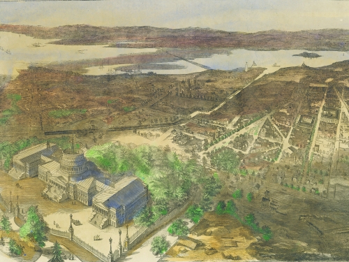
This map depicts the 10 square miles Pierre L'Enfant originally laid out as the nation's capital city. The map, created in 1862 by civil engineer E.G. Arnold, provides interesting details on the "white," "free colored," and "slave" populations in Washington, Georgetown and Alexandria...plus all of the Union army fort positions and roads into the city. The three-foot-square folding map was considered a threat to national security because, if it fell into the hands of the Confederate Army, it would help the enemy invade the city. Two days after it was offered for sale, all copies and the printing plates were confiscated by the War Department. From the Smithsonian Anacostia Community Museum exhibition "How the Civil War Changed Washington," on view through Nov. 15, 2015.
Image courtesy of Library of Congress, Geography and Maps Division.